Strath Creek Falls
This waterfall, located in the Mount Disappointment State Forest, has been popular with visitors for over 150 years. The walk leads to the amazing view of the falls cascading 50 metres over the rock face and into the gully below. The return walk is about 1km and takes 45 minutes. Although the Falls are best…
Read MorePhantom Falls
As the Taggerty River winds its way through the valley floor, a few kilometres west of Marysville along the well-maintained gravel road Lady Talbot Drive, you’ll find beautiful Phantom Falls. For falls access, follow the signs veering left along a fern-lined track of approximately 100 metres. Suitable for 2WD in dry weather only, there is…
Read MoreArt on the Great Victorian Rail Trail
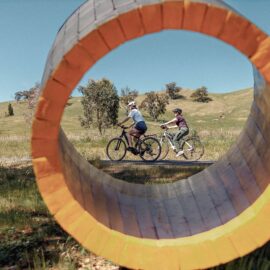
Eight artists have created seven major art installations and 20 scar trees spread along the Great Victorian Rail Trail, taking inspiration from the themes of connection to country, the local environment and the history of the trail. Explore a journey of artistic discovery through beautiful Taungurung Country on the 134km trail that follows the historic…
Read MoreTrawool Valley
Trawool, originally named ‘Traawool’, the indigenous word for ‘wild water’, is a district dominated by agriculture, dairy and unforgettable scenery. The area was first explored by Hume and Hovell in 1824, and later settled as a large sheep station. The district is bounded in the East by the Bald Hills and to the West by…
Read MoreHorseshoe Lagoon Flora and Fauna Reserve
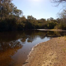
Horseshoe Lagoon is nestled in the bend of the Goulburn River between Kerrisdale and Trawool. The stunning surroundings and peaceful atmosphere make it the perfect place to enjoy outdoor activities such as camping and fishing. Walk in camping is allowed, no bookings or fees are required. Access to the camping area is approximately eight kilometers…
Read MoreMurrindindi Cascades
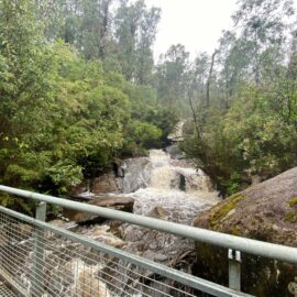
Embark on a short, scenic walk at Murrindindi Cascades, offering multiple viewpoints of the beautiful cascades. Located at the south end of Murrindindi Scenic Reserve, the track follows the first 300m of the Murrindindi River Walk, starting across the road from the Cascades Picnic Area. Descend through a forested valley to the Murrindindi River where…
Read MoreLucky Mine Lookout
Lucky Mine Lookout, named after one of the most successful early gold mines, which was located just below the top of the hill, overlooks the township of Alexandra and the valley it lies in. Located off Webster Street and up a gravel road within the Alexandra Bushland Reserve, this amazing lookout helps you to appreciate…
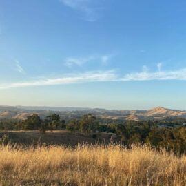
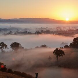
Read MoreMurchison Gap Lookout

Named after John Murchison an original squatter of one of the three original squatting runs in the district, this lookout sits right on the boundary of the Murrindindi region. A great platform juts out from the side of the hill here and it is a killer sunrise spot with the sun coming up behind the…
Read MoreAcheron Cutting Lookout
Acheron Cutting Lookout is a roadside lookout located on the Maroondah Highway, 7.2 kilometers (six minutes drive) from Alexandra and 11 kilometers from Taggerty (eight minutes drive). The lookout has now taken its place and has become one of the district’s most used scenic lookouts. The view extends over the Goulburn River Valley to the…
Read MoreMcKenzie Flora Reserve

McKenzie Flora Reserve covers 47 hectares and was originally set aside to provide timber for gold mines and as you walk the three walking tracks which link to form short circuits of almost 2km each you will pass several excavations and other evidence of past mining activity. Located on the south side of the Alexandra…
Read More